Model Submission Guidelines
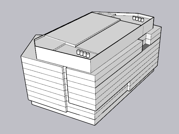
Building and Bridge models in the BPDA's city model collection are managed in a geographical database that treats models as singular objects associated with attributes. Building models are triangulated mesh objects representing the exterior shell of the building.
Model Level of Detail
Here are some additional guidelines for model geometry level of detail:
- Our model includes a detailed terrain model. If ground-level details such as entryways are at different elevations, these must be represented correctly.
- You are welcome to represent the underground portions of your structure. But this is not required.
- To eliminate floating corners when using terrain settings of different quality, it is helpful to extend your model a few feet below the ground.
- If a building is attached to pre-existing structures it is helpful to represent these as discretely grouped geometry.
- If a project has multiple buildings or construction / permitting phases it is best if these are separated into individual .OBJ files.
- Parts of the building that protrude or recess from the vertical facade by more than a foot and are more than a foot tall, like porticos and entryways should be represented.
- Window openings should not be cut out or indented.
- It is OK to divide your model into stories.
Simple Wavefront Object Format
We have found that various 3D model formats allow geometry types that do not translate well when we import them into our GIS-Based management scheme. This is why we prefer that models be submitted as the simplest possible triangulated mesh in Wavefront Object (OBJ) format.
- Triangulate all faces on export.
- Orient axes: Z Up, Y Forward.
- Please do not use single faces that would have both sides exposed. Many tools wil represent these as invisible from one side or the other.
- Use a plain white flat shader for all faces in your model, and include the .mtl file with your export.
- If your model uses materials and or textures, we would be happy to accept a textured as an alternate version.
Use the links below to view screen-shots of the export options for your favorite tool. If we don;t have a screenshot for your favorite tool, feel free to send one to paulbcote at gmail.
OBJ Export Option Dialogs
Context and Geo-Location
The citySchema project has developed a tiling and coordinate referencing scheme that bridges between design tools and GIS. The BPDA uses this coordinate frame for exporting its detailed base models that will be convenient for situating your model. The Tile Grid and Coordinate System page provides the tile referencing grid in many popular 3D formats.
Watch the video demonstration of using the metro3D tile grid to coordinate exchange of models between the BPDA's model collection and your project models. This technique allows you to keep whatever local site origin you might be using.
Preferred:
If it is possible for you to submit your model using our Metro Boston 3D coordinate referencing system, that would be preferred.
Fallback
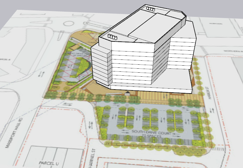
If it is not possible to export your model using the metro-3D coordinate system, please include a ground-plan reference image as shown in the illustration above. The groundplan should show enough of the edge of pavement in the context area to verify that the model is registered correctly. This groundplan can be included in the OBJ file as a single face with the image mapped as a texture.
Optional Source Material
Our archival system is capable of storing source material, including the plans and elevations and other information that may be part of the project proposal. We can also keep working models -- for example SketchUp or .3DS files. We are SketchUp Users, so if you have a SketchUp file of your model this may be helpful in case we need to do any trouble-shooting.
On-Going Work In Progress
This submission procedure is a work in progress, so we anticipate problems and hope to work with the development community to make it as easy as possible to participate in building our collaborative open=-source city model!